 vesseltracker.com
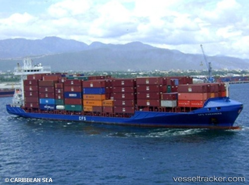
 PARADERO
Current Status
Where is the vessel?
PARADERO is currently in 22 nm N of Cayo Coco, based on AIS data received about 1h ago.
Latest AIS update:
Current position: 22.85333° N, 78.60167° W (22 nm N of Cayo Coco)
Average speed (last 7 days): Loading…
Average speed (last 30 days): Loading…
Vessel profile: PARADERO is a Container Ship with dimensions 140m x 22m.
This page combines live AIS, route history, probable destination signals, nearby traffic, and port activity for practical vessel monitoring.
The current position of vessel PARADERO is 22.85333 lat / -78.60167 lng. Updated: 2026-04-07 18:14:45 UTCNearest reference points:
- 36 nm E of Cayo Coco
- 11 nm S of Lyford Cay
- 28 nm NE of VARADERO
Currently sailing under the flag of Antigua and Barbuda ![]()
PARADERO built in 2007 year
Deadweight:
11193 tDetails:
Live Vessel PARADERO Analytics (details, animations, etc.)
Recent AIS points (UTC):
2026-04-07 11:56:45 UTC · 22.03126, -77.15269 · SOG 15.2 kn · COG 298°2026-04-07 14:01:45 UTC · 22.31174, -77.62786 · SOG 15.2 kn · COG 307°
2026-04-07 15:59:43 UTC · 22.58333, -78.08333 · SOG 15 kn · COG -1°
2026-04-07 18:14:45 UTC · 22.85333, -78.60167 · SOG 14 kn · COG -1°