 vesseltracker.com
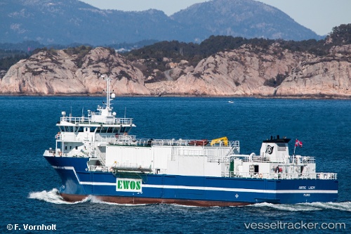
 Aqua Lady
Current Status
Where is the vessel?
Aqua Lady is currently in Near Forøy, based on AIS data received about 1h ago.
Latest AIS update:
Current position: 66.74483° N, 13.49969° E (Near Forøy)
Average speed (last 7 days): Loading…
Average speed (last 30 days): Loading…
Vessel profile: Aqua Lady is a Multi Purpose Carrier with dimensions 60m x 14m.
This page combines live AIS, route history, probable destination signals, nearby traffic, and port activity for practical vessel monitoring.
The current position of vessel Aqua Lady is 66.74483 lat / 13.49969 lng. Updated: 2026-03-29 13:19:34 UTCNearest reference points:
- Near Ørnes
- Near Tonnes
- Near Lurøy
Currently sailing under the flag of Norway ![]()
Aqua Lady built in 2006 year
Deadweight:
1350 tDetails:
Live Vessel Aqua Lady Analytics (details, animations, etc.)
Recent AIS points (UTC):
2026-03-29 07:55:35 UTC · 66.74485, 13.49962 · SOG 0 kn · COG 3°2026-03-29 09:58:30 UTC · 66.74484, 13.49963 · SOG 0 kn · COG 3°
2026-03-29 11:43:35 UTC · 66.74484, 13.49967 · SOG 0 kn · COG 3°
2026-03-29 13:19:34 UTC · 66.74483, 13.49969 · SOG 0 kn · COG 3°