 vesseltracker.com
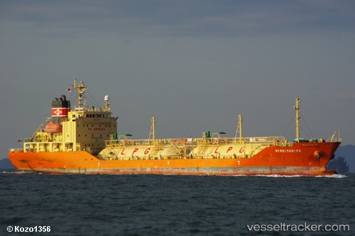
 LPG GRIYA NIAS
Current Status
Where is the vessel?
LPG GRIYA NIAS is currently in 20 nm NE of PANGKALAN SUSU, based on AIS data received about 1h ago.
Latest AIS update:
Current position: 4.41030° N, 98.38043° E (20 nm NE of PANGKALAN SUSU)
Average speed (last 7 days): Loading…
Average speed (last 30 days): Loading…
Vessel profile: LPG GRIYA NIAS is a Lpg Tanker with dimensions m x m.
This page combines live AIS, route history, probable destination signals, nearby traffic, and port activity for practical vessel monitoring.
The current position of vessel LPG GRIYA NIAS is 4.41030 lat / 98.38043 lng. Updated: 2026-03-31 09:26:34 UTCNearest reference points:
- 43 nm NE of PANGKALAN SUSU
- Near Belawan
- 10 nm NE of Belawan
Currently sailing under the flag of Indonesia ![]()
Details:
Live Vessel LPG GRIYA NIAS Analytics (details, animations, etc.)
Recent AIS points (UTC):
2026-03-31 03:39:15 UTC · 4.11815, 98.20552 · SOG 0 kn · COG 41°2026-03-31 06:21:15 UTC · 4.11817, 98.20552 · SOG 0 kn · COG 41°
2026-03-31 07:56:13 UTC · 4.16393, 98.33642 · SOG 8.1 kn · COG 51°
2026-03-31 09:26:34 UTC · 4.41030, 98.38043 · SOG 12.1 kn · COG 349°