 vesseltracker.com
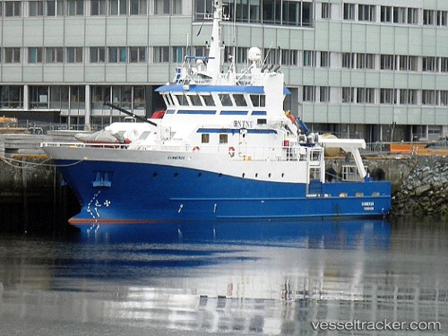
 Gunnerus
Current Status
Where is the vessel?
Gunnerus is currently in Near Kolvereid, based on AIS data received less than 1h ago.
Latest AIS update:
Current position: 63.43840° N, 10.40887° E (Near Kolvereid)
Average speed (last 7 days): Loading…
Average speed (last 30 days): Loading…
Vessel profile: Gunnerus is a Research Vessel with dimensions 36m x 8m.
This page combines live AIS, route history, probable destination signals, nearby traffic, and port activity for practical vessel monitoring.
The current position of vessel Gunnerus is 63.43840 lat / 10.40887 lng. Updated: 2026-04-15 19:48:45 UTCNearest reference points:
- Near Trondheim
- Near Leksvik
- Near Hommelvik
Currently sailing under the flag of Norway ![]()
Gunnerus built in 2006 year
Deadweight:
107 tDetails:
Live Vessel Gunnerus Analytics (details, animations, etc.)
Recent AIS points (UTC):
2026-04-15 14:09:43 UTC · 63.43838, 10.40892 · SOG 0 kn · COG 202°2026-04-15 15:48:37 UTC · 63.43841, 10.40890 · SOG 0 kn · COG 202°
2026-04-15 17:21:46 UTC · 63.43840, 10.40891 · SOG 0 kn · COG 203°
2026-04-15 19:48:45 UTC · 63.43840, 10.40887 · SOG 0 kn · COG 203°