 vesseltracker.com
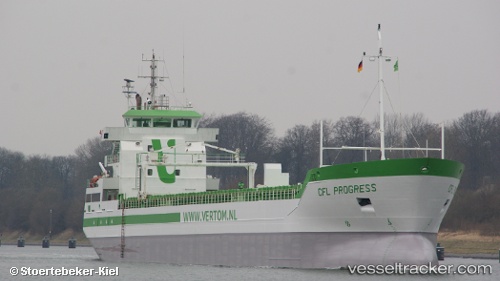
 Progress
Current Status
Where is the vessel?
Progress is currently in Near Cadgwith, based on AIS data received less than 1h ago.
Latest AIS update:
Current position: 49.82675° N, 5.12531° W (Near Cadgwith)
Average speed (last 7 days): Loading…
Average speed (last 30 days): Loading…
Vessel profile: Progress is a Multi Purpose Carrier with dimensions 118m x 13m.
This page combines live AIS, route history, probable destination signals, nearby traffic, and port activity for practical vessel monitoring.
The current position of vessel Progress is 49.82675 lat / -5.12531 lng. Updated: 2026-04-13 17:25:59 UTCNearest reference points:
- Near Cadgwith
- Near Flushing
- Near Falmouth
Currently sailing under the flag of Netherlands ![]()
Progress built in 2009 year
Deadweight:
6510 tDetails:
Live Vessel Progress Analytics (details, animations, etc.)
Recent AIS points (UTC):
2026-04-13 12:00:19 UTC · 49.92419, -3.92583 · SOG 9.1 kn · COG 262°2026-04-13 13:46:19 UTC · 49.89169, -4.32404 · SOG 8.4 kn · COG 262°
2026-04-13 15:39:29 UTC · 49.85757, -4.73202 · SOG 8.5 kn · COG 262°
2026-04-13 17:25:59 UTC · 49.82675, -5.12531 · SOG 8.6 kn · COG 262°