 vesseltracker.com
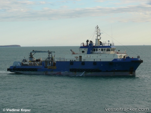
 Tanux I
Current Status
Where is the vessel?
Tanux I is currently in 59 nm N of Bartin, based on AIS data received about 22h ago.
Latest AIS update:
Current position: 42.65833° N, 32.04667° E (59 nm N of Bartin)
Average speed (last 7 days): Loading…
Average speed (last 30 days): Loading…
Vessel profile: Tanux I is a Offshore Support Vessel with dimensions 54m x 14m.
This page combines live AIS, route history, probable destination signals, nearby traffic, and port activity for practical vessel monitoring.
The current position of vessel Tanux I is 42.65833 lat / 32.04667 lng. Updated: 2026-04-09 23:14:46 UTCNearest reference points:
- Near Cide
- 27 nm NW of INEBOLU
- Near Erdemir
Currently sailing under the flag of Marshall Is ![]()
Tanux I built in 2006 year
Deadweight:
949 tDetails:
Live Vessel Tanux I Analytics (details, animations, etc.)
Recent AIS points (UTC):
2026-04-09 22:05:41 UTC · 42.71500, 32.10167 · SOG 5 kn · COG -1°2026-04-09 23:14:46 UTC · 42.65833, 32.04667 · SOG 4 kn · COG -1°
2026-04-09 23:14:46 UTC · 42.65833, 32.04667 · SOG 4 kn · COG -1°
2026-04-09 23:14:46 UTC · 42.65833, 32.04667 · SOG 4 kn · COG -1°