 vesseltracker.com
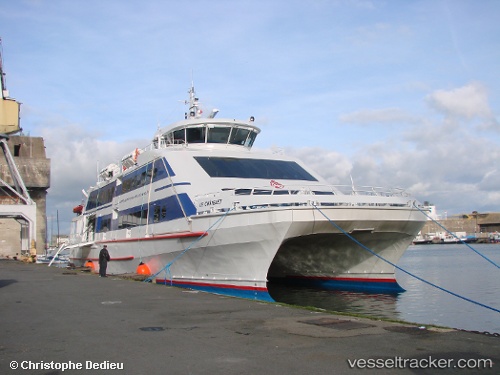
 Le Chatelet
Current Status
Where is the vessel?
Le Chatelet is currently in Near L'Île-d'Yeu, based on AIS data received about 1h ago.
Latest AIS update:
Current position: 46.72523° N, 2.34689° W (Near L'Île-d'Yeu)
Average speed (last 7 days): Loading…
Average speed (last 30 days): Loading…
Vessel profile: Le Chatelet is a Passenger Ship with dimensions 46m x 46m.
This page combines live AIS, route history, probable destination signals, nearby traffic, and port activity for practical vessel monitoring.
The current position of vessel Le Chatelet is 46.72523 lat / -2.34689 lng. Updated: 2026-04-17 07:24:13 UTCNearest reference points:
- Near LA BARRE DE MONTS
- 17 nm S of L'Île-d'Yeu
- 13 nm S of Saint-Céols
Currently sailing under the flag of France ![]()
Details:
Live Vessel Le Chatelet Analytics (details, animations, etc.)
Recent AIS points (UTC):
2026-04-17 02:03:47 UTC · 46.72521, -2.34689 · SOG 0 kn · COG 161°2026-04-17 04:10:28 UTC · 46.72525, -2.34689 · SOG 0.1 kn · COG 161°
2026-04-17 05:45:07 UTC · 46.72526, -2.34687 · SOG 0 kn · COG 160°
2026-04-17 07:24:13 UTC · 46.72523, -2.34689 · SOG 0 kn · COG 161°