 vesseltracker.com
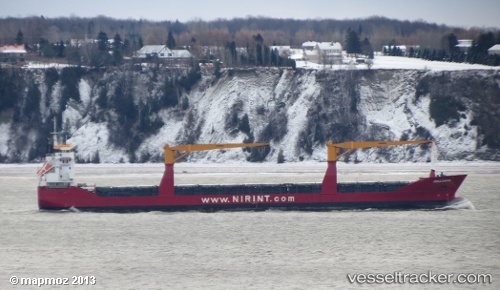
 PUKA
PUKA
Current Status
Where is the vessel?
PUKA is currently in Near Dégrad des Cannes, based on AIS data received less than 1h ago.
Latest AIS update:
Current position: 4.85333° N, 52.27500° W (Near Dégrad des Cannes)
Average speed (last 7 days): Loading…
Average speed (last 30 days): Loading…
Vessel profile: PUKA is a General Cargo with dimensions m x m.
This page combines live AIS, route history, probable destination signals, nearby traffic, and port activity for practical vessel monitoring.
The current position of vessel PUKA is 4.85333 lat / -52.27500 lng. Updated: 2026-04-20 21:40:39 UTCDetails:
Live Vessel PUKA Analytics (details, animations, etc.)
Recent AIS points (UTC):
2026-04-20 17:33:56 UTC · 4.85333, -52.27500 · SOG 0 kn · COG -1°2026-04-20 19:19:15 UTC · 4.85333, -52.27500 · SOG 0 kn · COG -1°
2026-04-20 19:25:13 UTC · 4.85333, -52.27500 · SOG 0 kn · COG -1°
2026-04-20 21:40:39 UTC · 4.85333, -52.27500 · SOG 0 kn · COG -1°