 vesseltracker.com
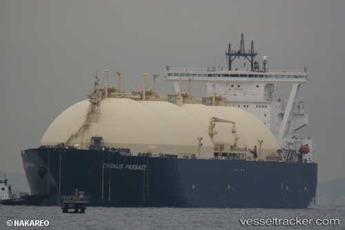
 Cygnus Passage
Current Status
Where is the vessel?
Cygnus Passage is currently in 15 nm S of Korsakov, based on AIS data received about 1h ago.
Latest AIS update:
Current position: 46.37722° N, 142.76413° E (15 nm S of Korsakov)
Average speed (last 7 days): Loading…
Average speed (last 30 days): Loading…
Vessel profile: Cygnus Passage is a Lng Tanker with dimensions 288m x 49m.
This page combines live AIS, route history, probable destination signals, nearby traffic, and port activity for practical vessel monitoring.
The current position of vessel Cygnus Passage is 46.37722 lat / 142.76413 lng. Updated: 2026-04-18 13:34:27 UTCNearest reference points:
- Near Korsakov
- Near ANIVA
- Near Cape Crillon
Currently sailing under the flag of Bahamas ![]()
Cygnus Passage built in 2009 year
Deadweight:
79555 tDetails:
Live Vessel Cygnus Passage Analytics (details, animations, etc.)
Recent AIS points (UTC):
2026-04-18 08:19:27 UTC · 46.37967, 142.76662 · SOG 0.1 kn · COG 174°2026-04-18 10:04:27 UTC · 46.37940, 142.76590 · SOG 0 kn · COG 159°
2026-04-18 12:07:27 UTC · 46.37960, 142.76768 · SOG 0.1 kn · COG 192°
2026-04-18 13:34:27 UTC · 46.37722, 142.76413 · SOG 0.3 kn · COG 97°