 vesseltracker.com
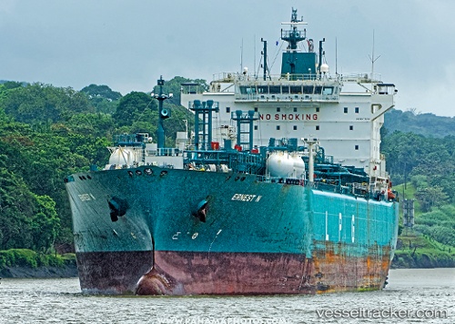
 Ernest N
Current Status
Where is the vessel?
Ernest N is currently in Near Port Bolivar, based on AIS data received about 1h ago.
Latest AIS update:
Current position: 29.31846° N, 94.57455° W (Near Port Bolivar)
Average speed (last 7 days): Loading…
Average speed (last 30 days): Loading…
Vessel profile: Ernest N is a Lpg Tanker with dimensions 205m x 32m.
This page combines live AIS, route history, probable destination signals, nearby traffic, and port activity for practical vessel monitoring.
The current position of vessel Ernest N is 29.31846 lat / -94.57455 lng. Updated: 2026-03-27 01:25:08 UTCNearest reference points:
- 12 nm SE of Port Bolivar
- Near Port Bolivar
- Near Texas City
Currently sailing under the flag of Liberia ![]()
Ernest N built in 2009 year
Deadweight:
43563 tDetails:
Live Vessel Ernest N Analytics (details, animations, etc.)
Recent AIS points (UTC):
2026-03-26 19:31:08 UTC · 29.31842, -94.57397 · SOG 0 kn · COG 195°2026-03-26 21:40:08 UTC · 29.31845, -94.57456 · SOG 0 kn · COG 175°
2026-03-26 23:55:08 UTC · 29.31846, -94.57465 · SOG 0 kn · COG 173°
2026-03-27 01:25:08 UTC · 29.31846, -94.57455 · SOG 0 kn · COG 175°