 vesseltracker.com
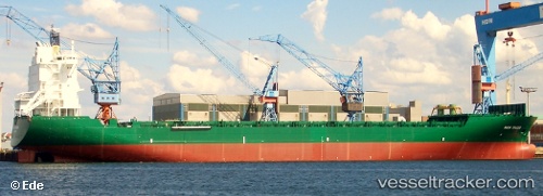
 PAPU
PAPU
Current Status
Where is the vessel?
PAPU is currently in 18 nm S of Karachi, based on AIS data received about 21h ago.
Latest AIS update:
Current position: 24.52229° N, 66.99715° E (18 nm S of Karachi)
Average speed (last 7 days): Loading…
Average speed (last 30 days): Loading…
Vessel profile: PAPU is a Container Ship with dimensions m x m.
This page combines live AIS, route history, probable destination signals, nearby traffic, and port activity for practical vessel monitoring.
The current position of vessel PAPU is 24.52229 lat / 66.99715 lng. Updated: 2026-04-10 06:58:14 UTCNearest reference points:
- 16 nm S of Kiamari
- Near Kiamari
- Near PORT QASIM
Currently sailing under the flag of Liberia ![]()
Details:
Live Vessel PAPU Analytics (details, animations, etc.)
Recent AIS points (UTC):
2026-04-10 01:48:20 UTC · 24.51997, 66.99792 · SOG 0 kn · COG -1°2026-04-10 03:27:22 UTC · 24.52057, 66.99806 · SOG 0.1 kn · COG -1°
2026-04-10 05:53:42 UTC · 24.52185, 66.99755 · SOG 0 kn · COG -1°
2026-04-10 06:58:14 UTC · 24.52229, 66.99715 · SOG 0 kn · COG -1°