 vesseltracker.com
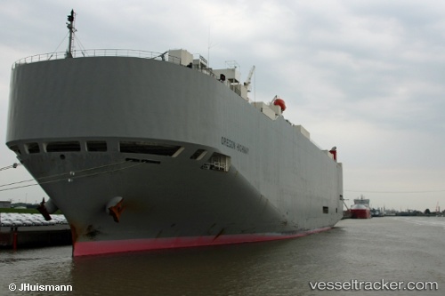
Oregon Highway
Current StatusWhere is the vessel?
Oregon Highway is currently in 72 nm SE of Las Brujas, based on AIS data received less than 1h ago.
Latest AIS update:
Current position: 22.61927° N, 17.59432° W (72 nm SE of Las Brujas)
Average speed (last 7 days): Loading…
Average speed (last 30 days): Loading…
Vessel profile: Oregon Highway is a Vehicles Carrier with dimensions 32m x 199m.
This page combines live AIS, route history, probable destination signals, nearby traffic, and port activity for practical vessel monitoring.
The current position of vessel Oregon Highway is 22.61927 lat / -17.59432 lng. Updated: 2026-04-20 23:51:53 UTCNearest reference points:
- 41 nm NW of Nouadhibou
- Near Nouadhibou
- 68 nm NW of Ad Dakhla
Details:
Live Vessel Oregon Highway Analytics (details, animations, etc.)
Recent AIS points (UTC):
2026-04-20 19:49:31 UTC · 21.43143, -17.76953 · SOG 17.7 kn · COG 15°2026-04-20 21:43:57 UTC · 21.99694, -17.71284 · SOG 17.8 kn · COG 9°
2026-04-20 22:18:38 UTC · 22.16678, -17.68354 · SOG 17.9 kn · COG 11°
2026-04-20 23:51:53 UTC · 22.61927, -17.59432 · SOG 17.7 kn · COG 10°