 vesseltracker.com
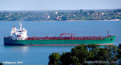
 Gulf Muttrah
Current Status
Where is the vessel?
Gulf Muttrah is currently in 30 nm N of Bryher, based on AIS data received about 1h ago.
Latest AIS update:
Current position: 50.44743° N, 6.45440° W (30 nm N of Bryher)
Average speed (last 7 days): Loading…
Average speed (last 30 days): Loading…
Vessel profile: Gulf Muttrah is a Chemical Oil Products Tanker with dimensions 183m x 32m.
This page combines live AIS, route history, probable destination signals, nearby traffic, and port activity for practical vessel monitoring.
The current position of vessel Gulf Muttrah is 50.44743 lat / -6.45440 lng. Updated: 2026-04-19 12:01:30 UTCNearest reference points:
- Near Isles of Scilly
- 10 nm NW of Grampound
- 45 nm SE of Covent Garden
Currently sailing under the flag of Bahamas ![]()
Details:
Live Vessel Gulf Muttrah Analytics (details, animations, etc.)
Recent AIS points (UTC):
2026-04-19 08:14:41 UTC · 49.97705, -7.32168 · SOG 12.1 kn · COG 43°2026-04-19 09:58:00 UTC · 50.20415, -6.93263 · SOG 11.6 kn · COG 49°
2026-04-19 10:23:00 UTC · 50.25515, -6.83710 · SOG 11.5 kn · COG 49°
2026-04-19 12:01:30 UTC · 50.44743, -6.45440 · SOG 11.6 kn · COG 52°