 vesseltracker.com
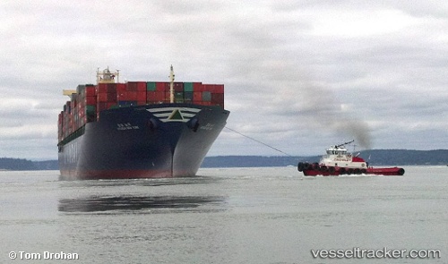
Hyundai New York
Current StatusWhere is the vessel?
Hyundai New York is currently in 130 nm E of Vinh Cam Ranh, based on AIS data received about 12h ago.
Latest AIS update:
Current position: 11.05822° N, 111.18990° E (130 nm E of Vinh Cam Ranh)
Average speed (last 7 days): Loading…
Average speed (last 30 days): Loading…
Vessel profile: Hyundai New York is a Container Ship with dimensions 40m x 293m.
This page combines live AIS, route history, probable destination signals, nearby traffic, and port activity for practical vessel monitoring.
The current position of vessel Hyundai New York is 11.05822 lat / 111.18990 lng. Updated: 2026-04-05 02:06:13 UTCNearest reference points:
- 163 nm E of Vinh Cam Ranh
- 156 nm SE of Phan Rang-Tháp Chàm
- 211 nm N of Pulau Lang Lang
Details:
Live Vessel Hyundai New York Analytics (details, animations, etc.)
Recent AIS points (UTC):
2026-04-05 01:09:17 UTC · 10.86988, 111.02660 · SOG 15 kn · COG 48°2026-04-05 02:06:13 UTC · 11.05822, 111.18990 · SOG 15 kn · COG 43°
2026-04-05 02:06:13 UTC · 11.05822, 111.18990 · SOG 15 kn · COG 43°
2026-04-05 02:06:13 UTC · 11.05822, 111.18990 · SOG 15 kn · COG 43°