 vesseltracker.com
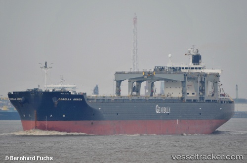
Corella Arrow
Current StatusWhere is the vessel?
Corella Arrow is currently in 13 nm NE of Jingjiang, based on AIS data received less than 1h ago.
Latest AIS update:
Current position: 31.18838° N, 122.62880° E (13 nm NE of Jingjiang)
Average speed (last 7 days): Loading…
Average speed (last 30 days): Loading…
Vessel profile: Corella Arrow is a Bulk Carrier with dimensions 32m x 225m.
This page combines live AIS, route history, probable destination signals, nearby traffic, and port activity for practical vessel monitoring.
The current position of vessel Corella Arrow is 31.18838 lat / 122.62880 lng. Updated: 2026-04-18 05:32:26 UTCNearest reference points:
- 15 nm NE of Jingjiang
- 17 nm NE of Jingjiang
- 14 nm N of Lü-hua Shan
Details:
Live Vessel Corella Arrow Analytics (details, animations, etc.)
Recent AIS points (UTC):
2026-04-17 23:50:18 UTC · 31.18633, 122.62337 · SOG 0.2 kn · COG 64°2026-04-18 01:35:27 UTC · 31.18822, 122.62371 · SOG 0.1 kn · COG 109°
2026-04-18 03:50:22 UTC · 31.19010, 122.62549 · SOG 0.2 kn · COG 162°
2026-04-18 05:32:26 UTC · 31.18838, 122.62880 · SOG 0.1 kn · COG 255°