 vesseltracker.com
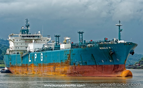
 GAS LAGOON
Current Status
Where is the vessel?
GAS LAGOON is currently in 26 nm E of Offshore Fujairah, based on AIS data received less than 1h ago.
Latest AIS update:
Current position: 25.13300° N, 57.12883° E (26 nm E of Offshore Fujairah)
Average speed (last 7 days): Loading…
Average speed (last 30 days): Loading…
Vessel profile: GAS LAGOON is a Lpg Tanker with dimensions m x m.
This page combines live AIS, route history, probable destination signals, nearby traffic, and port activity for practical vessel monitoring.
The current position of vessel GAS LAGOON is 25.13300 lat / 57.12883 lng. Updated: 2026-04-21 12:00:49 UTCNearest reference points:
- 42 nm SE of Offshore Fujairah
- Near Offshore Fujairah
- 30 nm NE of Offshore Fujairah
Currently sailing under the flag of Panama ![]()
Details:
Live Vessel GAS LAGOON Analytics (details, animations, etc.)
Recent AIS points (UTC):
2026-04-21 08:24:45 UTC · 25.11917, 57.06967 · SOG 0.7 kn · COG 348°2026-04-21 09:27:34 UTC · 25.12317, 57.08500 · SOG 0.8 kn · COG 345°
2026-04-21 10:06:05 UTC · 25.12550, 57.09583 · SOG 0.9 kn · COG 323°
2026-04-21 12:00:49 UTC · 25.13300, 57.12883 · SOG 0.8 kn · COG 351°