 vesseltracker.com
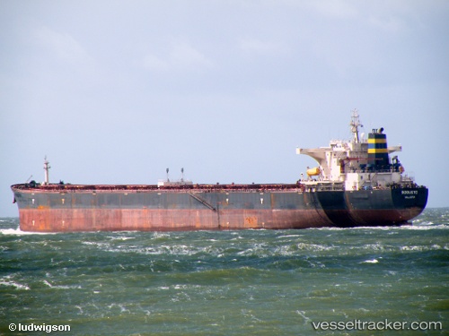
 ROBUSTO
Current Status
Where is the vessel?
ROBUSTO is currently in 97 nm SW of YORK, based on AIS data received about 2h ago.
Latest AIS update:
Current position: 6.90833° N, 13.95333° W (97 nm SW of YORK)
Average speed (last 7 days): Loading…
Average speed (last 30 days): Loading…
Vessel profile: ROBUSTO is a Bulk Carrier with dimensions m x m.
This page combines live AIS, route history, probable destination signals, nearby traffic, and port activity for practical vessel monitoring.
The current position of vessel ROBUSTO is 6.90833 lat / -13.95333 lng. Updated: 2026-03-28 10:12:51 UTCNearest reference points:
- 126 nm SW of YORK
- Near NASSIT
- Near Kissy
Currently sailing under the flag of Liberia ![]()
Details:
Live Vessel ROBUSTO Analytics (details, animations, etc.)
Recent AIS points (UTC):
2026-03-28 03:36:38 UTC · 7.93794, -14.61101 · SOG 10.8 kn · COG 147°2026-03-28 06:20:48 UTC · 7.50607, -14.34172 · SOG 10.8 kn · COG 145°
2026-03-28 08:21:05 UTC · 7.19863, -14.14243 · SOG 11.1 kn · COG 147°
2026-03-28 10:12:51 UTC · 6.90833, -13.95333 · SOG 11 kn · COG -1°