 vesseltracker.com
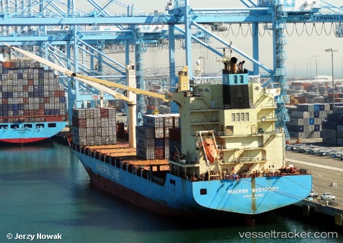
Maersk Westport
Current StatusWhere is the vessel?
Maersk Westport is currently in 80 nm W of Essaouira, based on AIS data received less than 1h ago.
Latest AIS update:
Current position: 31.74500° N, 11.01333° W (80 nm W of Essaouira)
Average speed (last 7 days): Loading…
Average speed (last 30 days): Loading…
Vessel profile: Maersk Westport is a Container Ship with dimensions 28m x 175m.
This page combines live AIS, route history, probable destination signals, nearby traffic, and port activity for practical vessel monitoring.
The current position of vessel Maersk Westport is 31.74500 lat / -11.01333 lng. Updated: 2026-04-02 10:01:06 UTCNearest reference points:
- 87 nm W of Essaouira
- 64 nm W of Essaouira
- 80 nm S of Jarjis
Details:
Live Vessel Maersk Westport Analytics (details, animations, etc.)
Recent AIS points (UTC):
2026-04-02 03:40:03 UTC · 32.84333, -9.84167 · SOG 13 kn · COG -1°2026-04-02 05:46:05 UTC · 32.48167, -10.22667 · SOG 14 kn · COG -1°
2026-04-02 07:51:48 UTC · 32.12807, -10.62200 · SOG 13.8 kn · COG 223°
2026-04-02 10:01:06 UTC · 31.74500, -11.01333 · SOG 13 kn · COG -1°