 vesseltracker.com
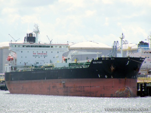
 JOHNNY RANGER
Current Status
Where is the vessel?
JOHNNY RANGER is currently in 55 nm N of ROATAN, based on AIS data received about 1h ago.
Latest AIS update:
Current position: 17.18259° N, 86.17909° W (55 nm N of ROATAN)
Average speed (last 7 days): Loading…
Average speed (last 30 days): Loading…
Vessel profile: JOHNNY RANGER is a Chemical/Oil Products Tanker with dimensions 32m x 182m.
This page combines live AIS, route history, probable destination signals, nearby traffic, and port activity for practical vessel monitoring.
The current position of vessel JOHNNY RANGER is 17.18259 lat / -86.17909 lng. Updated: 2026-04-18 18:01:13 UTCNearest reference points:
- 26 nm SE of Dangriga
- 14 nm SE of Belize
- 12 nm SW of Dangriga
Currently sailing under the flag of Liberia ![]()
JOHNNY RANGER built in 2008 year
Deadweight:
50922 tDetails:
Live Vessel JOHNNY RANGER Analytics (details, animations, etc.)
Recent AIS points (UTC):
2026-04-18 12:25:06 UTC · 17.50259, -85.02433 · SOG 12.9 kn · COG 271°2026-04-18 13:40:37 UTC · 17.49147, -85.30484 · SOG 12.7 kn · COG 271°
2026-04-18 14:24:34 UTC · 17.48519, -85.46772 · SOG 12.8 kn · COG 269°
2026-04-18 18:01:13 UTC · 17.18259, -86.17909 · SOG 12.6 kn · COG 231°