 vesseltracker.com
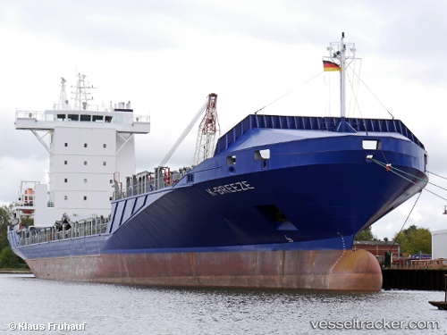
 K breeze
Current Status
Where is the vessel?
K breeze is currently in Near Puerto Barrios, based on AIS data received about 2h ago.
Latest AIS update:
Current position: 15.82573° N, 88.60914° W (Near Puerto Barrios)
Average speed (last 7 days): Loading…
Average speed (last 30 days): Loading…
Vessel profile: K breeze is a Container Ship with dimensions 139m x 139m.
This page combines live AIS, route history, probable destination signals, nearby traffic, and port activity for practical vessel monitoring.
The current position of vessel K breeze is 15.82573 lat / -88.60914 lng. Updated: 2026-03-27 03:33:11 UTCNearest reference points:
- 14 nm NW of Puerto Cortes
- 12 nm SW of Dangriga
- 26 nm SE of Dangriga
Currently sailing under the flag of Antigua Barbuda ![]()
K breeze built in 2008 year
Deadweight:
11181 tDetails:
Live Vessel K breeze Analytics (details, animations, etc.)
Recent AIS points (UTC):
2026-03-26 22:09:11 UTC · 15.82560, -88.60877 · SOG 0.1 kn · COG 318°2026-03-26 23:33:12 UTC · 15.82551, -88.60902 · SOG 0.1 kn · COG 46°
2026-03-27 02:06:22 UTC · 15.82558, -88.60914 · SOG 0.1 kn · COG 61°
2026-03-27 03:33:11 UTC · 15.82573, -88.60914 · SOG 0 kn · COG 112°