 vesseltracker.com
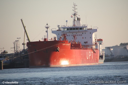
 BRONX
BRONX
Current Status
Where is the vessel?
BRONX is currently in Near Jorf Lasfar, based on AIS data received about 3h ago.
Latest AIS update:
Current position: 33.14500° N, 8.69333° W (Near Jorf Lasfar)
Average speed (last 7 days): Loading…
Average speed (last 30 days): Loading…
Vessel profile: BRONX is a Crude Oil Tanker with dimensions 184m x 27m.
This page combines live AIS, route history, probable destination signals, nearby traffic, and port activity for practical vessel monitoring.
The current position of vessel BRONX is 33.14500 lat / -8.69333 lng. Updated: 2026-04-16 04:50:50 UTCNearest reference points:
- Near Jorf Lasfar
- 21 nm NW of El Jadida
- 44 nm NW of El Jadida
Currently sailing under the flag of Liberia ![]()
BRONX built in 2008 year
Deadweight:
37602 tDetails:
Live Vessel BRONX Analytics (details, animations, etc.)
Recent AIS points (UTC):
2026-04-15 23:38:49 UTC · 33.14500, -8.69333 · SOG 0 kn · COG -1°2026-04-16 01:22:14 UTC · 33.14581, -8.69368 · SOG 0.3 kn · COG -1°
2026-04-16 01:32:51 UTC · 33.14500, -8.69333 · SOG 0 kn · COG -1°
2026-04-16 04:50:50 UTC · 33.14500, -8.69333 · SOG 0 kn · COG -1°