 vesseltracker.com
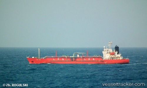
 Gas Aria
Current Status
Where is the vessel?
Gas Aria is currently in 34 nm N of Langsa Venture FPSO, based on AIS data received about 2h ago.
Latest AIS update:
Current position: 5.86152° N, 98.22215° E (34 nm N of Langsa Venture FPSO)
Average speed (last 7 days): Loading…
Average speed (last 30 days): Loading…
Vessel profile: Gas Aria is a Lpg Tanker with dimensions 106m x 106m.
This page combines live AIS, route history, probable destination signals, nearby traffic, and port activity for practical vessel monitoring.
The current position of vessel Gas Aria is 5.86152 lat / 98.22215 lng. Updated: 2026-04-02 11:32:06 UTCNearest reference points:
- 45 nm N of Langsa Venture FPSO
- 34 nm N of Langsa Venture FPSO
- 18 nm E of Langsa Venture FPSO
Currently sailing under the flag of Indonesia ![]()
Gas Aria built in 2007 year
Deadweight:
5349 tDetails:
Live Vessel Gas Aria Analytics (details, animations, etc.)
Recent AIS points (UTC):
2026-04-02 06:20:44 UTC · 5.47078, 98.56907 · SOG 0.5 kn · COG -1°2026-04-02 07:51:49 UTC · 5.46443, 98.57012 · SOG 0.2 kn · COG -1°
2026-04-02 09:39:36 UTC · 5.56200, 98.49907 · SOG 12.5 kn · COG 317°
2026-04-02 11:32:06 UTC · 5.86152, 98.22215 · SOG 13.3 kn · COG 319°