 vesseltracker.com
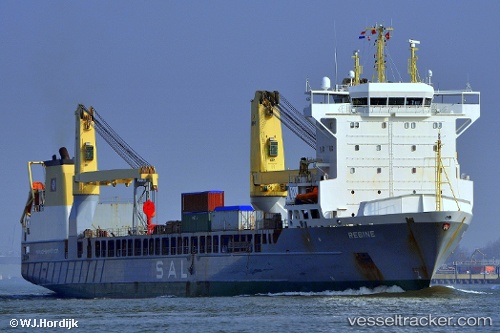
 REGINE
Current Status
Where is the vessel?
REGINE is currently in 216 nm SW of Hastings Apt/Freetown, based on AIS data received about 2h ago.
Latest AIS update:
Current position: 5.74370° N, 15.62467° W (216 nm SW of Hastings Apt/Freetown)
Average speed (last 7 days): Loading…
Average speed (last 30 days): Loading…
Vessel profile: REGINE is a General Cargo with dimensions m x m.
This page combines live AIS, route history, probable destination signals, nearby traffic, and port activity for practical vessel monitoring.
The current position of vessel REGINE is 5.74370 lat / -15.62467 lng. Updated: 2026-03-27 03:58:38 UTCNearest reference points:
- 126 nm SW of YORK
- Open sea, approx. 405 nm off the nearest listed port
- Open sea, approx. 408 nm off the nearest listed port
Currently sailing under the flag of Portugal ![]()
Details:
Live Vessel REGINE Analytics (details, animations, etc.)
Recent AIS points (UTC):
2026-03-26 21:48:04 UTC · 7.19423, -16.45287 · SOG 16.2 kn · COG 160°2026-03-26 23:55:24 UTC · 6.65262, -16.25271 · SOG 16.1 kn · COG 160°
2026-03-27 02:20:13 UTC · 6.09586, -15.91058 · SOG 16.5 kn · COG 141°
2026-03-27 03:58:38 UTC · 5.74370, -15.62467 · SOG 16.5 kn · COG 141°