 vesseltracker.com
 DETROIT MAS
Current Status
Where is the vessel?
DETROIT MAS is currently in Near Semarang, based on AIS data received less than 1h ago.
Latest AIS update:
Current position: 6.94167° S, 110.42333° E (Near Semarang)
Average speed (last 7 days): Loading…
Average speed (last 30 days): Loading…
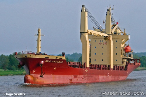
Vessel profile: DETROIT MAS is a General Cargo Ship with dimensions 20m x 117m.
This page combines live AIS, route history, probable destination signals, nearby traffic, and port activity for practical vessel monitoring.
The current position of vessel DETROIT MAS is -6.94167 lat / 110.42333 lng. Updated: 2026-04-02 07:41:48 UTCNearest reference points:
- Near Batang
- 26 nm N of Pemalang
- 49 nm NE of TANJUNG JATI
Currently sailing under the flag of Indonesia ![]()
DETROIT MAS built in 2008 year
Deadweight:
7709 tDetails:
Live Vessel DETROIT MAS Analytics (details, animations, etc.)
Recent AIS points (UTC):
2026-04-02 02:28:47 UTC · -6.94194, 110.42337 · SOG 0 kn · COG 184°2026-04-02 03:28:38 UTC · -6.94193, 110.42336 · SOG 0 kn · COG 184°
2026-04-02 05:59:49 UTC · -6.94167, 110.42333 · SOG 0 kn · COG -1°
2026-04-02 07:41:48 UTC · -6.94167, 110.42333 · SOG 0 kn · COG -1°