 vesseltracker.com
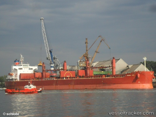
 HARVEST
Current Status
Where is the vessel?
HARVEST is currently in Near MCID - Private Terminal, based on AIS data received less than 1h ago.
Latest AIS update:
Current position: 23.02564° N, 113.52317° E (Near MCID - Private Terminal)
Average speed (last 7 days): Loading…
Average speed (last 30 days): Loading…
Vessel profile: HARVEST is a Bulk Carrier with dimensions m x m.
This page combines live AIS, route history, probable destination signals, nearby traffic, and port activity for practical vessel monitoring.
The current position of vessel HARVEST is 23.02564 lat / 113.52317 lng. Updated: 2026-04-07 13:35:33 UTCNearest reference points:
- Near MCID - Private Terminal
- Near Shilou
- Near Xinsha
Currently sailing under the flag of Palau ![]()
Details:
Live Vessel HARVEST Analytics (details, animations, etc.)
Recent AIS points (UTC):
2026-04-07 07:24:03 UTC · 23.02567, 113.52318 · SOG 0 kn · COG 337°2026-04-07 09:55:33 UTC · 23.02559, 113.52309 · SOG 0 kn · COG 337°
2026-04-07 12:22:09 UTC · 23.02500, 113.52167 · SOG 0 kn · COG -1°
2026-04-07 13:35:33 UTC · 23.02564, 113.52317 · SOG 0 kn · COG 336°