 vesseltracker.com
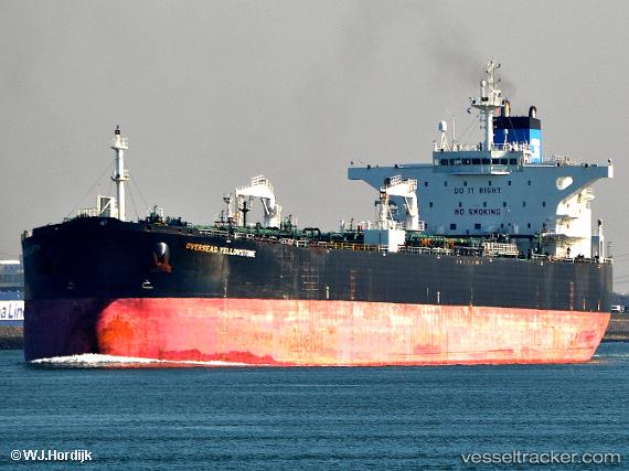
Seaways Yellowstone
Current StatusWhere is the vessel?
Seaways Yellowstone is currently in Near Los Angeles, based on AIS data received less than 1h ago.
Latest AIS update:
Current position: 33.69730° N, 118.21768° W (Near Los Angeles)
Average speed (last 7 days): Loading…
Average speed (last 30 days): Loading…
Vessel profile: Seaways Yellowstone is a Crude Oil Tanker with dimensions 44m x 250m.
This page combines live AIS, route history, probable destination signals, nearby traffic, and port activity for practical vessel monitoring.
The current position of vessel Seaways Yellowstone is 33.69730 lat / -118.21768 lng. Updated: 2026-04-06 10:26:24 UTCNearest reference points:
- Near Long Beach
- Near Los Angeles
- Near Seal Beach
Details:
Live Vessel Seaways Yellowstone Analytics (details, animations, etc.)
Recent AIS points (UTC):
2026-04-06 03:29:23 UTC · 33.69625, -118.21747 · SOG 0 kn · COG 278°2026-04-06 06:20:25 UTC · 33.69528, -118.21847 · SOG 0 kn · COG 306°
2026-04-06 07:53:27 UTC · 33.69562, -118.21827 · SOG 0 kn · COG 296°
2026-04-06 10:26:24 UTC · 33.69730, -118.21768 · SOG 0 kn · COG 252°