 vesseltracker.com
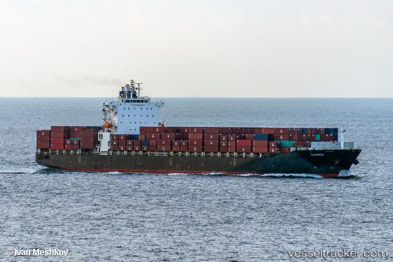
 BAHAMAS
Current Status
Where is the vessel?
BAHAMAS is currently in 30 nm E of Slipi, based on AIS data received less than 1h ago.
Latest AIS update:
Current position: 6.13032° N, 107.28935° E (30 nm E of Slipi)
Average speed (last 7 days): Loading…
Average speed (last 30 days): Loading…
Vessel profile: BAHAMAS is a Container Ship with dimensions 259m x 32m.
This page combines live AIS, route history, probable destination signals, nearby traffic, and port activity for practical vessel monitoring.
The current position of vessel BAHAMAS is 6.13032 lat / 107.28935 lng. Updated: 2026-04-15 03:18:21 UTCNearest reference points:
- 36 nm SW of Slipi
- 46 nm E of Kakap Natuna Terminal
- 45 nm E of Kakap Natuna Terminal
Currently sailing under the flag of Liberia ![]()
BAHAMAS built in 2010 year
Deadweight:
52173 tDetails:
Live Vessel BAHAMAS Analytics (details, animations, etc.)
Recent AIS points (UTC):
2026-04-14 19:55:42 UTC · 4.44426, 106.09042 · SOG 16.4 kn · COG 35°2026-04-14 22:13:43 UTC · 4.96944, 106.46270 · SOG 16.5 kn · COG 34°
2026-04-14 23:13:58 UTC · 5.19588, 106.62283 · SOG 16.7 kn · COG -1°
2026-04-15 03:18:21 UTC · 6.13032, 107.28935 · SOG 16.7 kn · COG -1°