 vesseltracker.com
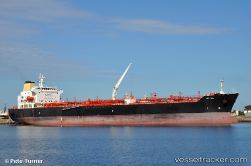
 SAN REMO
Current Status
Where is the vessel?
SAN REMO is currently in Near Choa Chu Kang, based on AIS data received about 1h ago.
Latest AIS update:
Current position: 1.26403° N, 103.91272° E (Near Choa Chu Kang)
Average speed (last 7 days): Loading…
Average speed (last 30 days): Loading…
Vessel profile: SAN REMO is a Oil/Chemical Tanker with dimensions m x m.
This page combines live AIS, route history, probable destination signals, nearby traffic, and port activity for practical vessel monitoring.
The current position of vessel SAN REMO is 1.26403 lat / 103.91272 lng. Updated: 2026-04-18 15:38:31 UTCNearest reference points:
- Near Choa Chu Kang
- Near Tampines
- Near Changi
Currently sailing under the flag of Portugal ![]()
Details:
Live Vessel SAN REMO Analytics (details, animations, etc.)
Recent AIS points (UTC):
2026-04-18 09:44:26 UTC · 1.27730, 104.08813 · SOG 8.2 kn · COG 260°2026-04-18 11:31:36 UTC · 1.25718, 103.90880 · SOG 2.6 kn · COG 45°
2026-04-18 14:05:49 UTC · 1.26333, 103.91167 · SOG 0 kn · COG -1°
2026-04-18 15:38:31 UTC · 1.26403, 103.91272 · SOG 0 kn · COG 78°