 vesseltracker.com
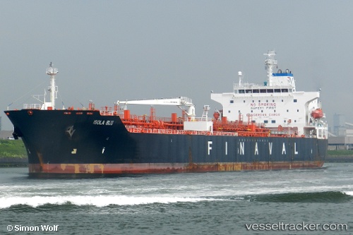
 TURKELI
Current Status
Where is the vessel?
TURKELI is currently in 37 nm E of Orzola, based on AIS data received about 1h ago.
Latest AIS update:
Current position: 29.27748° N, 12.74282° W (37 nm E of Orzola)
Average speed (last 7 days): Loading…
Average speed (last 30 days): Loading…
Vessel profile: TURKELI is a Oil/Chemical Tanker with dimensions m x m.
This page combines live AIS, route history, probable destination signals, nearby traffic, and port activity for practical vessel monitoring.
The current position of vessel TURKELI is 29.27748 lat / -12.74282 lng. Updated: 2026-04-18 11:34:52 UTCNearest reference points:
- Near Lanzarote
- 84 nm NE of ORZOLA
- Near LAS COLORADAS
Currently sailing under the flag of Panama ![]()
Details:
Live Vessel TURKELI Analytics (details, animations, etc.)
Recent AIS points (UTC):
2026-04-18 05:49:43 UTC · 28.34667, -13.53057 · SOG 12 kn · COG 37°2026-04-18 07:47:10 UTC · 28.66024, -13.25980 · SOG 11.8 kn · COG 37°
2026-04-18 09:30:02 UTC · 28.93388, -13.02498 · SOG 12 kn · COG 34°
2026-04-18 11:34:52 UTC · 29.27748, -12.74282 · SOG 12.3 kn · COG 34°