 vesseltracker.com
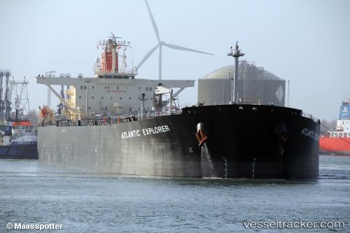
 ATLANTIC EXPLORER
Current Status
Where is the vessel?
ATLANTIC EXPLORER is currently in 55 nm E of Kampung Jawa, based on AIS data received about 1h ago.
Latest AIS update:
Current position: 3.04648° N, 104.43500° E (55 nm E of Kampung Jawa)
Average speed (last 7 days): Loading…
Average speed (last 30 days): Loading…
Vessel profile: ATLANTIC EXPLORER is a Crude Oil Tanker with dimensions m x m.
This page combines live AIS, route history, probable destination signals, nearby traffic, and port activity for practical vessel monitoring.
The current position of vessel ATLANTIC EXPLORER is 3.04648 lat / 104.43500 lng. Updated: 2026-04-18 05:57:44 UTCNearest reference points:
- 80 nm SW of Terempa
- 64 nm NE of PENGERANG
- 53 nm NE of PENGERANG
Currently sailing under the flag of Malaysia ![]()
Details:
Live Vessel ATLANTIC EXPLORER Analytics (details, animations, etc.)
Recent AIS points (UTC):
2026-04-17 22:59:53 UTC · 4.26960, 103.84953 · SOG 11.7 kn · COG 144°2026-04-18 02:10:57 UTC · 3.75868, 104.21977 · SOG 12.1 kn · COG -1°
2026-04-18 03:21:12 UTC · 3.54403, 104.31455 · SOG 11.8 kn · COG -1°
2026-04-18 05:57:44 UTC · 3.04648, 104.43500 · SOG 11.7 kn · COG -1°