 vesseltracker.com
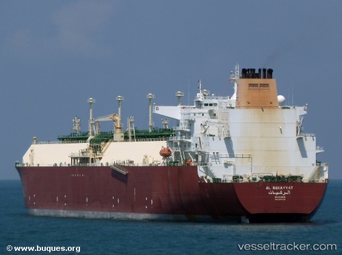
Al Rekayyat
Current StatusWhere is the vessel?
Al Rekayyat is currently in 30 nm SW of Kiamari, based on AIS data received less than 1h ago.
Latest AIS update:
Current position: 24.56368° N, 66.50033° E (30 nm SW of Kiamari)
Average speed (last 7 days): Loading…
Average speed (last 30 days): Loading…
Vessel profile: Al Rekayyat is a Lng Tanker with dimensions 50m x 315m.
This page combines live AIS, route history, probable destination signals, nearby traffic, and port activity for practical vessel monitoring.
The current position of vessel Al Rekayyat is 24.56368 lat / 66.50033 lng. Updated: 2026-04-17 19:21:12 UTCNearest reference points:
- 16 nm S of Kiamari
- Near Kiamari
- Near PORT QASIM
Details:
Live Vessel Al Rekayyat Analytics (details, animations, etc.)
Recent AIS points (UTC):
2026-04-17 14:09:01 UTC · 24.56296, 66.50046 · SOG 0 kn · COG 271°2026-04-17 15:55:09 UTC · 24.56355, 66.50039 · SOG 0 kn · COG -1°
2026-04-17 18:27:10 UTC · 24.56358, 66.50036 · SOG 0.2 kn · COG 253°
2026-04-17 19:21:12 UTC · 24.56368, 66.50033 · SOG 0 kn · COG 252°