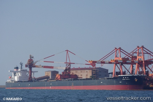
.
Vessel photo of Shin Koryu (IMO 9398149) vesseltracker.com

Shin Koryu

Vessel type: Ore Carrier | IMO: 9398149 | MMSI: MMSI: 356849000
Call sign: 3FSQ3 | Dimensions: 50 m x 300 m
Current Status

Where is the vessel?

Shin Koryu is currently in Open sea, approx. 472 nm off the nearest listed port, based on AIS data received about 1h ago.

Latest AIS update:

Current position: 0.40833° S, 85.50667° E (Open sea, approx. 472 nm off the nearest listed port)

Average speed (last 7 days): Loading…

Average speed (last 30 days): Loading…

Vessel profile: Shin Koryu is a Ore Carrier with dimensions 50m x 300m.

This page combines live AIS, route history, probable destination signals, nearby traffic, and port activity for practical vessel monitoring.

The current position of vessel Shin Koryu is -0.40833 lat / 85.50667 lng. Updated: 2026-04-12 06:36:55 UTC
Nearest reference points:
  • Open sea, approx. 472 nm off the nearest listed port
  • Open sea, approx. 471 nm off the nearest listed port
  • Open sea, approx. 474 nm off the nearest listed port
Details:

Live Vessel Shin Koryu Analytics (details, animations, etc.)


Recent AIS points (UTC):
2026-04-10 04:09:54 UTC · 5.15500, 93.54167 · SOG 12 kn · COG -1°
2026-04-10 05:48:49 UTC · 4.96333, 93.26167 · SOG 12 kn · COG -1°
2026-04-10 07:30:53 UTC · 4.77500, 92.97500 · SOG 12 kn · COG -1°
2026-04-12 06:36:55 UTC · -0.40833, 85.50667 · SOG 11 kn · COG -1°

Track of the vessel in the last 60 days


UTC: --
Start: -- Track timeline (UTC) End: --
Encountered: --


Link to the map:


Find another ship

Shin_Koryu (356849000) last ports (portcalls and passsages)

BAKAUHENI | 2025-08-30 06:21:48
Yen-Tai | 2025-08-16 11:47:30
PENGERANG | 2025-07-30 09:23:05
TANAH MERAH | 2025-07-30 07:48:01
BATU AMPAR | 2025-07-30 07:19:58
PULAU SAMBU | 2025-07-30 06:13:31
JURONG ISLAND | 2025-05-08 04:42:35
BATU AMPAR | 2025-05-08 02:35:34
TANAH MERAH | 2025-05-07 12:49:23
PENGERANG | 2025-05-07 11:17:03
Yen-Tai | 2025-04-24 08:41:30
BAKAUHENI | 2025-03-31 13:18:16
BUKOM ISLAND | 2025-01-07 11:57:10
PULAU SAMBU | 2025-01-07 11:19:40
TANAH MERAH | 2025-01-05 23:37:55
PENGERANG | 2025-01-05 22:06:36
Yen-Tai | 2024-12-26 12:19:10
Yen-Tai | 2024-12-22 12:07:20
PENGERANG | 2024-12-02 23:23:50
TANAH MERAH | 2024-12-02 22:04:42
PULAU SAMBU | 2024-12-02 20:47:00
Sambu | 2024-09-20 03:24:57
Rizhao | 2024-04-30 14:34:20
Rizhao | 2024-04-26 13:57:10
Selat Sunda | 2024-01-13 19:46:23
Map Ta Phut | 2024-01-08 02:22:13
Map Ta Phut | 2024-01-04 02:18:18
Newcastle | 2023-12-14 06:38:36
Singapore | 2023-11-03 20:41:28
Imabari | 2023-08-11 01:57:49
Samson Point | 2023-07-20 22:50:45
Samson Point | 2023-07-16 21:50:24
Samson Point | 2023-07-12 20:58:20
Imabari | 2023-07-02 01:38:11
Matsuga-hana | 2023-06-21 00:39:41
Samson Point | 2023-06-04 22:07:21
Samson Point | 2023-05-31 21:16:22
Samson Point | 2023-05-27 20:57:05
Taicang | 2023-05-14 14:32:23
Wusong | 2023-05-14 12:24:56
Taku Bar | 2023-05-08 06:12:35
Port Headland | 2023-04-20 06:07:41
Uno | 2023-01-21 23:03:01
Port Headland | 2023-01-05 15:02:44
Port Headland | 2022-11-16 17:35:25
Samson Point | 2022-10-04 01:33:23
Selat Lombok | 2022-07-22 16:09:52
Port Headland | 2022-07-18 16:57:14
Selat Lombok | 2022-07-14 01:16:23
Yokosuka | 2022-06-20 01:20:11
Yokohama | 2022-06-18 01:23:00
Kawasaki | 2022-06-16 04:53:08
Singapore | 2022-05-29 02:00:25
Port Louis | 2022-05-14 10:23:04
Sao Luiz | 2022-04-13 08:57:02
Sambu | 2022-01-14 03:00:51
Singapore | 2022-01-14 02:35:51
Sambu | 2022-01-14 02:00:15