 vesseltracker.com
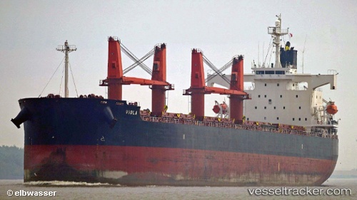
 JIN RONG
Current Status
Where is the vessel?
JIN RONG is currently in Near Al Fujayrah, based on AIS data received about 1h ago.
Latest AIS update:
Current position: 25.18179° N, 56.35884° E (Near Al Fujayrah)
Average speed (last 7 days): Loading…
Average speed (last 30 days): Loading…
Vessel profile: JIN RONG is a Bulk Carrier with dimensions 190m x 32m.
This page combines live AIS, route history, probable destination signals, nearby traffic, and port activity for practical vessel monitoring.
The current position of vessel JIN RONG is 25.18179 lat / 56.35884 lng. Updated: 2026-03-27 04:14:14 UTCNearest reference points:
- Near Fujairah
- Near KHORFAKKAN
- Near Offshore Fujairah
Currently sailing under the flag of Hong Kong, China ![]()
JIN RONG built in 2008 year
Deadweight:
58729 tDetails:
Live Vessel JIN RONG Analytics (details, animations, etc.)
Recent AIS points (UTC):
2026-03-26 22:22:57 UTC · 25.18175, 56.35878 · SOG 0 kn · COG 2°2026-03-26 23:43:57 UTC · 25.18175, 56.35877 · SOG 0 kn · COG 2°
2026-03-27 02:01:57 UTC · 25.18175, 56.35876 · SOG 0 kn · COG 2°
2026-03-27 04:14:14 UTC · 25.18179, 56.35884 · SOG 0 kn · COG 2°