 vesseltracker.com
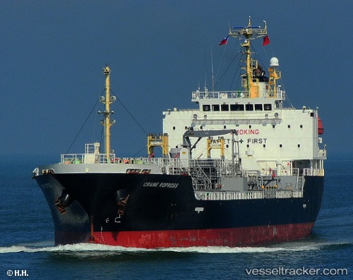
 Dl Ruby
Current Status
Where is the vessel?
Dl Ruby is currently in 13 nm SW of Incheon, based on AIS data received about 2h ago.
Latest AIS update:
Current position: 37.31037° N, 126.40908° E (13 nm SW of Incheon)
Average speed (last 7 days): Loading…
Average speed (last 30 days): Loading…
Vessel profile: Dl Ruby is a Chemical Oil Products Tanker with dimensions 120m x 20m.
This page combines live AIS, route history, probable destination signals, nearby traffic, and port activity for practical vessel monitoring.
The current position of vessel Dl Ruby is 37.31037 lat / 126.40908 lng. Updated: 2026-03-28 19:54:55 UTCNearest reference points:
- 14 nm SW of Incheon
- 10 nm N of DAESAN
- Near Incheon
Currently sailing under the flag of Korea ![]()
Dl Ruby built in 2008 year
Deadweight:
10288 tDetails:
Live Vessel Dl Ruby Analytics (details, animations, etc.)
Recent AIS points (UTC):
2026-03-28 14:24:54 UTC · 37.31198, 126.41064 · SOG 0 kn · COG 216°2026-03-28 16:12:54 UTC · 37.31206, 126.41024 · SOG 0 kn · COG 199°
2026-03-28 17:48:57 UTC · 37.31072, 126.40892 · SOG 0.1 kn · COG 79°
2026-03-28 19:54:55 UTC · 37.31037, 126.40908 · SOG 0 kn · COG 54°