 vesseltracker.com
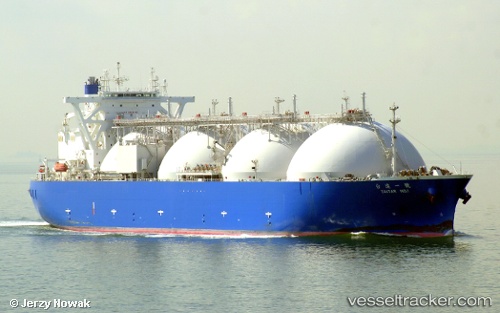
Taitar No.1
Current StatusWhere is the vessel?
Taitar No.1 is currently in Near East Arm, based on AIS data received less than 1h ago.
Latest AIS update:
Current position: 12.50864° S, 130.91406° E (Near East Arm)
Average speed (last 7 days): Loading…
Average speed (last 30 days): Loading…
Vessel profile: Taitar No.1 is a Lng Tanker with dimensions 48m x 290m.
This page combines live AIS, route history, probable destination signals, nearby traffic, and port activity for practical vessel monitoring.
The current position of vessel Taitar No.1 is -12.50864 lat / 130.91406 lng. Updated: 2026-04-12 15:38:04 UTCNearest reference points:
- Near Palmerston
- Near Winnellie
Details:
Live Vessel Taitar No.1 Analytics (details, animations, etc.)
Recent AIS points (UTC):
2026-04-12 10:12:20 UTC · -12.50833, 130.91333 · SOG 0 kn · COG -1°2026-04-12 11:47:01 UTC · -12.50870, 130.91412 · SOG 0 kn · COG 259°
2026-04-12 13:56:00 UTC · -12.50867, 130.91409 · SOG 0 kn · COG 259°
2026-04-12 15:38:04 UTC · -12.50864, 130.91406 · SOG 0 kn · COG 259°