 vesseltracker.com
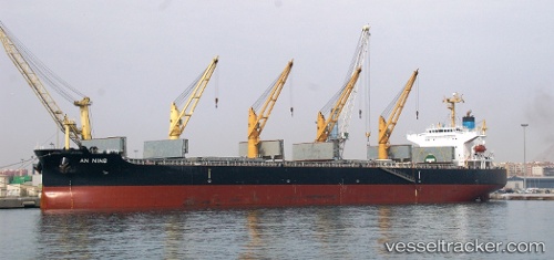
 XIN AN NING
Current Status
Where is the vessel?
XIN AN NING is currently in 11 nm S of Marshall, based on AIS data received about 2h ago.
Latest AIS update:
Current position: 5.95667° N, 10.40333° W (11 nm S of Marshall)
Average speed (last 7 days): Loading…
Average speed (last 30 days): Loading…
Vessel profile: XIN AN NING is a Bulk Carrier with dimensions 32m x 190m.
This page combines live AIS, route history, probable destination signals, nearby traffic, and port activity for practical vessel monitoring.
The current position of vessel XIN AN NING is 5.95667 lat / -10.40333 lng. Updated: 2026-04-18 17:26:13 UTCNearest reference points:
- 15 nm SW of Buchanan
- 110 nm SW of River Cess
Currently sailing under the flag of China Peopless Republic ![]()
XIN AN NING built in 2009 year
Deadweight:
55256 tDetails:
Live Vessel XIN AN NING Analytics (details, animations, etc.)
Recent AIS points (UTC):
2026-04-18 11:32:15 UTC · 5.83500, -10.14833 · SOG 11 kn · COG -1°2026-04-18 13:24:03 UTC · 5.91798, -10.35748 · SOG 1.3 kn · COG 289°
2026-04-18 15:11:16 UTC · 5.93333, -10.37833 · SOG 0 kn · COG -1°
2026-04-18 17:26:13 UTC · 5.95667, -10.40333 · SOG 0 kn · COG -1°