 vesseltracker.com
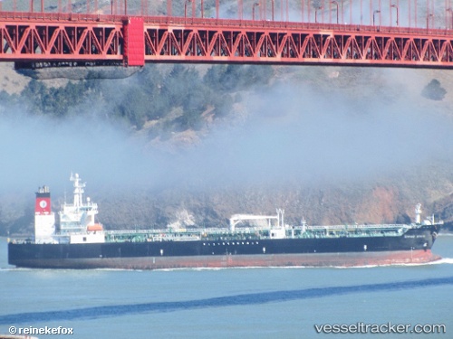
 Empire State
Current Status
Where is the vessel?
Empire State is currently in 23 nm W of Ocean Beach, based on AIS data received about 2h ago.
Latest AIS update:
Current position: 32.68778° N, 117.68965° W (23 nm W of Ocean Beach)
Average speed (last 7 days): Loading…
Average speed (last 30 days): Loading…
Vessel profile: Empire State is a Chemical Oil Products Tanker with dimensions 183m x 32m.
This page combines live AIS, route history, probable destination signals, nearby traffic, and port activity for practical vessel monitoring.
The current position of vessel Empire State is 32.68778 lat / -117.68965 lng. Updated: 2026-03-28 15:50:49 UTCNearest reference points:
- 35 nm W of Del Mar, San Diego
- Near Ocean Beach
- Near San Diego
Currently sailing under the flag of USA ![]()
Details:
Live Vessel Empire State Analytics (details, animations, etc.)
Recent AIS points (UTC):
2026-03-28 09:46:50 UTC · 33.48177, -118.18235 · SOG 9.9 kn · COG 161°2026-03-28 11:53:30 UTC · 33.15744, -118.00383 · SOG 8.4 kn · COG 152°
2026-03-28 14:11:30 UTC · 32.88347, -117.82952 · SOG 8.5 kn · COG 152°
2026-03-28 15:50:49 UTC · 32.68778, -117.68965 · SOG 7.5 kn · COG 99°