 vesseltracker.com
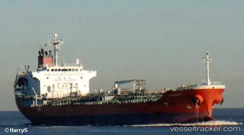
 MALED
MALED
Current Status
Where is the vessel?
MALED is currently in 67 nm E of DHAMRA, based on AIS data received about 2h ago.
Latest AIS update:
Current position: 20.63333° N, 88.13833° E (67 nm E of DHAMRA)
Average speed (last 7 days): Loading…
Average speed (last 30 days): Loading…
Vessel profile: MALED is a Oil/Chemical Tanker with dimensions m x m.
This page combines live AIS, route history, probable destination signals, nearby traffic, and port activity for practical vessel monitoring.
The current position of vessel MALED is 20.63333 lat / 88.13833 lng. Updated: 2026-04-07 01:28:56 UTCNearest reference points:
- 61 nm E of DHAMRA
- 56 nm SE of Contai
- 45 nm S of Contai
Currently sailing under the flag of Barbados ![]()
Details:
Live Vessel MALED Analytics (details, animations, etc.)
Recent AIS points (UTC):
2026-04-06 19:52:58 UTC · 21.63833, 87.90667 · SOG 12 kn · COG -1°2026-04-06 21:35:01 UTC · 21.30667, 87.82333 · SOG 9 kn · COG -1°
2026-04-06 23:52:58 UTC · 20.87667, 87.93667 · SOG 11 kn · COG -1°
2026-04-07 01:28:56 UTC · 20.63333, 88.13833 · SOG 11 kn · COG -1°