 vesseltracker.com
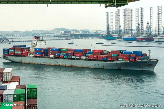
 SM PORTLAND
Current Status
Where is the vessel?
SM PORTLAND is currently in 29 nm N of NAKANOSHIMA, based on AIS data received less than 1h ago.
Latest AIS update:
Current position: 36.58713° N, 133.06107° E (29 nm N of NAKANOSHIMA)
Average speed (last 7 days): Loading…
Average speed (last 30 days): Loading…
Vessel profile: SM PORTLAND is a Container Ship with dimensions 32m x 261m.
This page combines live AIS, route history, probable destination signals, nearby traffic, and port activity for practical vessel monitoring.
The current position of vessel SM PORTLAND is 36.58713 lat / 133.06107 lng. Updated: 2026-04-16 21:32:28 UTCNearest reference points:
- 37 nm NW of NAKANOSHIMA
- 63 nm NW of Unnan
- 67 nm W of NAKANOSHIMA
Currently sailing under the flag of Korea (Republic of) ![]()
SM PORTLAND built in 2009 year
Deadweight:
51314 tDetails:
Live Vessel SM PORTLAND Analytics (details, animations, etc.)
Recent AIS points (UTC):
2026-04-16 13:59:21 UTC · 37.48000, 134.37500 · SOG 11 kn · COG -1°2026-04-16 16:10:36 UTC · 37.22807, 133.99385 · SOG 10.6 kn · COG 228°
2026-04-16 19:21:37 UTC · 36.84383, 133.45564 · SOG 11.2 kn · COG 236°
2026-04-16 21:32:28 UTC · 36.58713, 133.06107 · SOG 10.9 kn · COG 229°