 vesseltracker.com
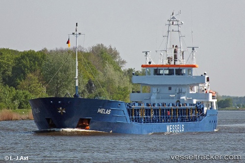
 Melas
Melas
Current Status
Where is the vessel?
Melas is currently in 11 nm SE of HELGOLAND, based on AIS data received less than 1h ago.
Latest AIS update:
Current position: 54.04959° N, 8.12007° E (11 nm SE of HELGOLAND)
Average speed (last 7 days): Loading…
Average speed (last 30 days): Loading…
Vessel profile: Melas is a Multi Purpose Carrier with dimensions 90m x 12m.
This page combines live AIS, route history, probable destination signals, nearby traffic, and port activity for practical vessel monitoring.
The current position of vessel Melas is 54.04959 lat / 8.12007 lng. Updated: 2026-04-22 08:17:18 UTCNearest reference points:
- 10 nm E of Wangerooge
- Near Wangerooge
- Near HOOKSIEL
Currently sailing under the flag of Antigua Barbuda ![]()
Melas built in 2010 year
Deadweight:
3675 tDetails:
Live Vessel Melas Analytics (details, animations, etc.)
Recent AIS points (UTC):
2026-04-22 04:18:04 UTC · 53.96902, 8.56768 · SOG 10.1 kn · COG 282°2026-04-22 05:38:00 UTC · 54.02435, 8.11909 · SOG 11.5 kn · COG 294°
2026-04-22 07:35:18 UTC · 54.04966, 8.12005 · SOG 0 kn · COG 113°
2026-04-22 08:17:18 UTC · 54.04959, 8.12007 · SOG 0 kn · COG 112°