 vesseltracker.com
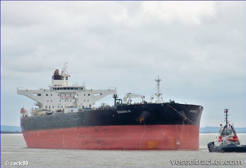
 Zouzou N
Current Status
Where is the vessel?
Zouzou N is currently in 55 nm W of Okha, based on AIS data received about 3d ago.
Latest AIS update:
Current position: 22.33265° N, 68.10433° E (55 nm W of Okha)
Average speed (last 7 days): Loading…
Average speed (last 30 days): Loading…
Vessel profile: Zouzou N is a Crude Oil Tanker with dimensions 274m x 50m.
This page combines live AIS, route history, probable destination signals, nearby traffic, and port activity for practical vessel monitoring.
The current position of vessel Zouzou N is 22.33265 lat / 68.10433 lng. Updated: 2026-04-03 15:39:18 UTCNearest reference points:
- 49 nm S of Positra
- 13 nm W of Måndvi
- 54 nm S of Positra
Currently sailing under the flag of Liberia ![]()
Zouzou N built in 2010 year
Deadweight:
149991 tDetails:
Live Vessel Zouzou N Analytics (details, animations, etc.)
Recent AIS points (UTC):
2026-04-03 15:39:18 UTC · 22.33265, 68.10433 · SOG 11.4 kn · COG -1°2026-04-03 15:39:18 UTC · 22.33265, 68.10433 · SOG 11.4 kn · COG -1°
2026-04-03 15:39:18 UTC · 22.33265, 68.10433 · SOG 11.4 kn · COG -1°
2026-04-03 15:39:18 UTC · 22.33265, 68.10433 · SOG 11.4 kn · COG -1°