 vesseltracker.com
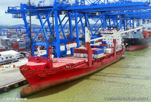
 Orinoco
Current Status
Where is the vessel?
Orinoco is currently in Near Bahía Las Minas, based on AIS data received about 1h ago.
Latest AIS update:
Current position: 9.43561° N, 79.86713° W (Near Bahía Las Minas)
Average speed (last 7 days): Loading…
Average speed (last 30 days): Loading…
Vessel profile: Orinoco is a Container Ship with dimensions 140m x 140m.
This page combines live AIS, route history, probable destination signals, nearby traffic, and port activity for practical vessel monitoring.
The current position of vessel Orinoco is 9.43561 lat / -79.86713 lng. Updated: 2026-04-03 21:23:40 UTCNearest reference points:
- Near COLON 2000
- Near Colon
- Near Colón Free Zone
Currently sailing under the flag of Singapore ![]()
Orinoco built in 2010 year
Deadweight:
12306 tDetails:
Live Vessel Orinoco Analytics (details, animations, etc.)
Recent AIS points (UTC):
2026-04-03 15:59:30 UTC · 9.41297, -79.88824 · SOG 7.1 kn · COG 43°2026-04-03 17:49:04 UTC · 9.43569, -79.86682 · SOG 0.7 kn · COG 34°
2026-04-03 19:58:26 UTC · 9.43585, -79.86750 · SOG 0.2 kn · COG 49°
2026-04-03 21:23:40 UTC · 9.43561, -79.86713 · SOG 0.4 kn · COG 37°