 vesseltracker.com
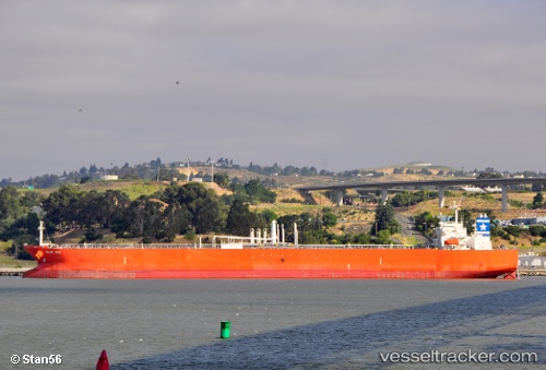
 BLUE SEA
Current Status
Where is the vessel?
BLUE SEA is currently in 257 nm SW of Port Blair, based on AIS data received about 7h ago.
Latest AIS update:
Current position: 8.55418° N, 89.78075° E (257 nm SW of Port Blair)
Average speed (last 7 days): Loading…
Average speed (last 30 days): Loading…
Vessel profile: BLUE SEA is a Crude Oil Tanker with dimensions m x m.
This page combines live AIS, route history, probable destination signals, nearby traffic, and port activity for practical vessel monitoring.
The current position of vessel BLUE SEA is 8.55418 lat / 89.78075 lng. Updated: 2026-03-28 13:51:03 UTCNearest reference points:
- 243 nm E of Abakaliki
Currently sailing under the flag of Portugal ![]()
Details:
Live Vessel BLUE SEA Analytics (details, animations, etc.)
Recent AIS points (UTC):
2026-03-28 13:51:03 UTC · 8.55418, 89.78075 · SOG 13.1 kn · COG 117°2026-03-28 13:51:03 UTC · 8.55418, 89.78075 · SOG 13.1 kn · COG 117°
2026-03-28 13:51:03 UTC · 8.55418, 89.78075 · SOG 13.1 kn · COG 117°
2026-03-28 13:51:03 UTC · 8.55418, 89.78075 · SOG 13.1 kn · COG 117°