 vesseltracker.com
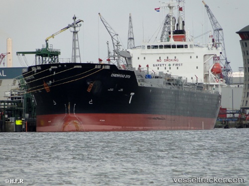
 Chemroad Dita
Current Status
Where is the vessel?
Chemroad Dita is currently in 32 nm SW of Kinfraa-SEZ/Thiruvananthapuram, based on AIS data received about 16h ago.
Latest AIS update:
Current position: 8.01500° N, 76.64644° E (32 nm SW of Kinfraa-SEZ/Thiruvananthapuram)
Average speed (last 7 days): Loading…
Average speed (last 30 days): Loading…
Vessel profile: Chemroad Dita is a Chemical Oil Products Tanker with dimensions 174m x 28m.
This page combines live AIS, route history, probable destination signals, nearby traffic, and port activity for practical vessel monitoring.
The current position of vessel Chemroad Dita is 8.01500 lat / 76.64644 lng. Updated: 2026-04-06 08:44:52 UTCNearest reference points:
- 41 nm S of Nagercoil
- 91 nm S of Nagercoil
- 98 nm S of Nagercoil
Currently sailing under the flag of Panama ![]()
Chemroad Dita built in 2009 year
Deadweight:
33554 tDetails:
Live Vessel Chemroad Dita Analytics (details, animations, etc.)
Recent AIS points (UTC):
2026-04-06 08:10:08 UTC · 8.00272, 76.65852 · SOG 13.2 kn · COG 316°2026-04-06 08:44:52 UTC · 8.01500, 76.64644 · SOG 13.2 kn · COG 316°
2026-04-06 08:44:52 UTC · 8.01500, 76.64644 · SOG 13.2 kn · COG 316°
2026-04-06 08:44:52 UTC · 8.01500, 76.64644 · SOG 13.2 kn · COG 316°