 vesseltracker.com
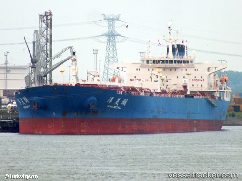
Yang Mei Hu
Current StatusWhere is the vessel?
Yang Mei Hu is currently in 106 nm NE of Jingjiang, based on AIS data received about 1h ago.
Latest AIS update:
Current position: 32.25460° N, 123.94447° E (106 nm NE of Jingjiang)
Average speed (last 7 days): Loading…
Average speed (last 30 days): Loading…
Vessel profile: Yang Mei Hu is a Crude Oil Tanker with dimensions 42m x 245m.
This page combines live AIS, route history, probable destination signals, nearby traffic, and port activity for practical vessel monitoring.
The current position of vessel Yang Mei Hu is 32.25460 lat / 123.94447 lng. Updated: 2026-04-07 20:23:24 UTCNearest reference points:
- 117 nm NE of Jingjiang
- 70 nm NE of Jingjiang
- 96 nm SW of Hwasun
Details:
Live Vessel Yang Mei Hu Analytics (details, animations, etc.)
Recent AIS points (UTC):
2026-04-07 13:56:04 UTC · 30.91506, 123.84714 · SOG 11.1 kn · COG 13°2026-04-07 15:27:58 UTC · 31.20500, 123.87667 · SOG 11 kn · COG -1°
2026-04-07 18:23:23 UTC · 31.82412, 123.89677 · SOG 13.2 kn · COG 0°
2026-04-07 20:23:24 UTC · 32.25460, 123.94447 · SOG 13 kn · COG 10°