 vesseltracker.com
 HADAL SALLY
Current Status
Where is the vessel?
HADAL SALLY is currently in 99 nm W of Los Ramos, based on AIS data received less than 1h ago.
Latest AIS update:
Current position: 37.63223° N, 12.39326° W (99 nm W of Los Ramos)
Average speed (last 7 days): Loading…
Average speed (last 30 days): Loading…
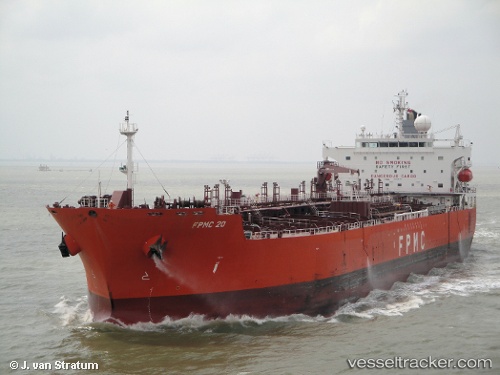
Vessel profile: HADAL SALLY is a Chemical Oil Products Tanker with dimensions 181m x 32m.
This page combines live AIS, route history, probable destination signals, nearby traffic, and port activity for practical vessel monitoring.
The current position of vessel HADAL SALLY is 37.63223 lat / -12.39326 lng. Updated: 2026-04-19 00:14:07 UTCNearest reference points:
- 97 nm W of Los Ramos
- 95 nm W of Los Ramos
- 94 nm W of Los Ramos
Currently sailing under the flag of Panama ![]()
HADAL SALLY built in 2009 year
Deadweight:
50994 tDetails:
Live Vessel HADAL SALLY Analytics (details, animations, etc.)
Recent AIS points (UTC):
2026-04-18 17:25:57 UTC · 38.99945, -11.88165 · SOG 12.7 kn · COG 196°2026-04-18 20:17:49 UTC · 38.42133, -12.09709 · SOG 12.4 kn · COG 196°
2026-04-18 21:24:27 UTC · 38.19573, -12.18280 · SOG 12.6 kn · COG 198°
2026-04-19 00:14:07 UTC · 37.63223, -12.39326 · SOG 12 kn · COG 196°