 vesseltracker.com
 Virgo
Virgo
Current Status
Where is the vessel?
Virgo is currently in 76 nm NE of Gross Koris, based on AIS data received about 1h ago.
Latest AIS update:
Current position: 14.24167° N, 53.33333° E (76 nm NE of Gross Koris)
Average speed (last 7 days): Loading…
Average speed (last 30 days): Loading…
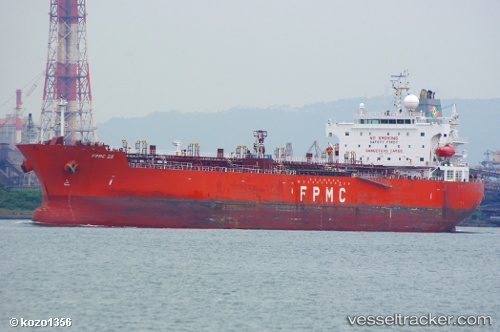
Vessel profile: Virgo is a Chemical Oil Products Tanker with dimensions 183m x 32m.
This page combines live AIS, route history, probable destination signals, nearby traffic, and port activity for practical vessel monitoring.
The current position of vessel Virgo is 14.24167 lat / 53.33333 lng. Updated: 2026-04-14 18:07:34 UTCNearest reference points:
- 110 nm NE of Gross Koris
- 106 nm S of Port Raysut
- 103 nm S of Port Raysut
Currently sailing under the flag of Liberia ![]()
Virgo built in 2010 year
Deadweight:
50997 tDetails:
Live Vessel Virgo Analytics (details, animations, etc.)
Recent AIS points (UTC):
2026-04-14 09:34:34 UTC · 13.90167, 51.58833 · SOG 13 kn · COG -1°2026-04-14 12:58:30 UTC · 14.13167, 52.30500 · SOG 12 kn · COG -1°
2026-04-14 16:10:37 UTC · 14.31333, 52.94833 · SOG 11 kn · COG -1°
2026-04-14 18:07:34 UTC · 14.24167, 53.33333 · SOG 11 kn · COG -1°