 vesseltracker.com
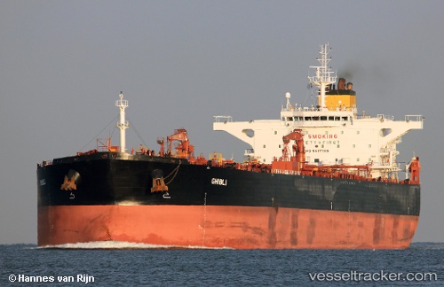
Vessel Ghibli IMO: 9417799, MMSI: 636014069 Crude Oil Tanker
UTC, 23.60400, 37.77721, course: 265, speed: 0.9
UTC, 23.62661, 37.77661, course: 199, speed: 0.8
2026-03-24 07:55:10 UTC, 23.65827, 37.78525, course: 292, speed: 1.1
Live Vessel Ghibli Analytics (details, animations, etc.)
Live AIS position: UTC. 27 nm SW of Yanbu), updated 2026-03-24 07:55:10 UTC.Find the position of the vessel Ghibli on the map. The latter are known coordinates and path.
marine traffic ship tracker show on live map
The current position of vessel Ghibli is 23.65827 lat / 37.78525 lng. Updated: 2026-03-24 07:55:10 UTCDetails:
Last coordinates of the vessel:
UTC, 23.57599, 37.77040, course: 282, speed: 0.9UTC, 23.60400, 37.77721, course: 265, speed: 0.9
UTC, 23.62661, 37.77661, course: 199, speed: 0.8
2026-03-24 07:55:10 UTC, 23.65827, 37.78525, course: 292, speed: 1.1