 vesseltracker.com
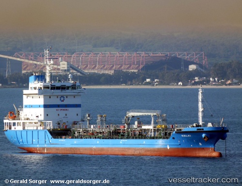
 HALKI
HALKI
Current Status
Where is the vessel?
HALKI is currently in Near Jeddah, based on AIS data received less than 1h ago.
Latest AIS update:
Current position: 21.44569° N, 39.12194° E (Near Jeddah)
Average speed (last 7 days): Loading…
Average speed (last 30 days): Loading…
Vessel profile: HALKI is a Oil Products Tanker with dimensions 102m x 18m.
This page combines live AIS, route history, probable destination signals, nearby traffic, and port activity for practical vessel monitoring.
The current position of vessel HALKI is 21.44569 lat / 39.12194 lng. Updated: 2026-04-14 03:54:41 UTCNearest reference points:
- Near Jeddah
- Near Tusdeer Free Zone
- 10 nm SW of Jeddah
Currently sailing under the flag of Cyprus ![]()
HALKI built in 2011 year
Deadweight:
6257 tDetails:
Live Vessel HALKI Analytics (details, animations, etc.)
Recent AIS points (UTC):
2026-04-13 21:23:45 UTC · 21.41440, 39.08264 · SOG 0.2 kn · COG 317°2026-04-14 00:06:35 UTC · 21.44082, 39.12107 · SOG 0 kn · COG 348°
2026-04-14 01:24:36 UTC · 21.44072, 39.12080 · SOG 0.1 kn · COG 359°
2026-04-14 03:54:41 UTC · 21.44569, 39.12194 · SOG 0.1 kn · COG 343°