 vesseltracker.com
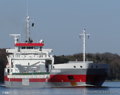
 Finnborg
Current Status
Where is the vessel?
Finnborg is currently in 32 nm E of Fox River (=riviere-Au-Renard), based on AIS data received about 1h ago.
Latest AIS update:
Current position: 49.05605° N, 63.57472° W (32 nm E of Fox River (=riviere-Au-Renard))
Average speed (last 7 days): Loading…
Average speed (last 30 days): Loading…
Vessel profile: Finnborg is a General Cargo Ship with dimensions 157m x 18m.
This page combines live AIS, route history, probable destination signals, nearby traffic, and port activity for practical vessel monitoring.
The current position of vessel Finnborg is 49.05605 lat / -63.57472 lng. Updated: 2026-03-31 05:20:42 UTCCurrently sailing under the flag of Netherlands ![]()
Finnborg built in 2011 year
Deadweight:
14603 tDetails:
Live Vessel Finnborg Analytics (details, animations, etc.)
Recent AIS points (UTC):
2026-03-31 00:06:42 UTC · 49.33996, -64.82332 · SOG 10.6 kn · COG 95°2026-03-31 02:20:20 UTC · 49.28628, -64.23855 · SOG 11.3 kn · COG 113°
2026-03-31 03:43:30 UTC · 49.17530, -63.91678 · SOG 9.3 kn · COG -1°
2026-03-31 05:20:42 UTC · 49.05605, -63.57472 · SOG 9.8 kn · COG 118°